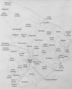
One of the main things that differentiates a One-Place Study from a family history study is that there is as much focus on ‘Place’ as on ‘People’. For this study, that means that we’re trying to understand as much about the properties of Bratton Clovelly as the families who lived in, conducted business in or owned these properties. Our goal is to eventually reconstruct the lineage of each property as far back in time as records permit. But our first step is to try to understand where the properties are located.

A great resource for this search is the Tithe Survey of 1845. Detailed maps and property descriptions were drawn up in response to the Tithe Commutation Act of 1836 which substituted a monetary payment for the wide variety of ‘tithes in kind’ that had previously been paid. The result of this is that we have maps that can pinpoint where each farm was in Bratton Clovelly in this timeframe, owners, tenants, the use that each parcel of land was being put to and a relative value for each parcel. Although the residences within Bratton Village itself are not generally named, the owners and tenants at each property unit in the village are identified similarly to the farm properties.
The maps and corresponding tithe apportionments are held at Devon Heritage Centre. We have used these maps (which are quite large) to provide a less detailed version for viewing on the website. Click here to get a better look at these maps and click here to see the tithe apportionments and detailed information describing each property. When viewing the tithe apportionments, notice the links in the ‘Property Detail’ column which will show you the breakdown of the small parcels of land (fields, houses etc) that make up each property.
Leave a Reply