Please check the Sources section for more detail on map sources.
Google Modern-day Map |
||||
View Bratton Clovelly, Devon in a larger map |
This modern map shows the location of Bratton Clovelly in West Devon. Terrain and satellite views are also available. | |||
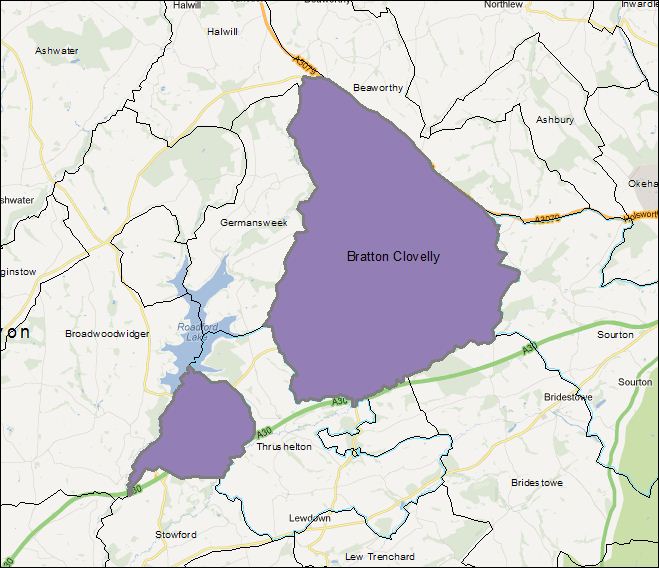
FamilySearch 1851 Jurisdiction Map |
||||
 Click map to enlarge |
This jurisdiction map from FamilySearch shows the boundaries of the Bratton Clovelly parish in 1851. From medieval times, the Bratton Clovelly parish had two disjoint parts. The larger part was called Bratton in the Domesday Book of 1086 and the smaller part was called Guscott, also seen as Godescote. In 1885, there was a boundary change that re-aligned the smaller part of the parish from Bratton Clovelly to Broadwoodwidger. | |||
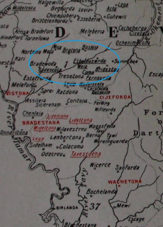
1086 Domesday Map |
||||
 Click map to enlarge Click map to enlarge |
This map from the Victoria County History of Devonshire shows the places identified in the Domesday Survey of 1086. You can see Bratona (Bratton), Bosleia (Boasley) and Godescota (Guscott or Godescote), along with neighbouring Bradewoda (Broadwood-widger). The survey details the amount of land, animals and other property, as well as the property holders. Baldwin the Sheriff held the places on the map that are underlined, including Bratton. | |||
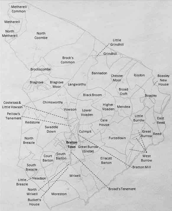
1845 Tithe Maps |
||||
 Click maps to enlarge |
We derived these maps from the 1845 Tithe Maps, available for viewing in much more detail at the Devon Heritage Centre (CDs also available for purchase). The larger part of the parish is on the map to the left and the smaller part is on the map to the right. Click here to see a close-up of Bratton Town and click here to see the transcript of the tithe apportionment that corresponds to these maps. | 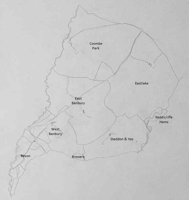 |
||
‘Vision of Britain’ Ordnance Survey Maps, 1806-1945 |
||||
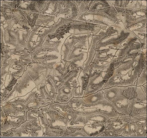 Click maps to enlarge Click maps to enlarge |
The Vision of Britain website contains an extensive collection of topographic, boundary and land use survey maps, including many covering Bratton Clovelly from 1806 to 1945. The 1806 Ordnance Survey topographic map on the left shows the amazing land, farm and transport detail available through time. The 1942 Ordnance Survey Land Use map on the right shows the variety of information available. On this map, brown signifies arable land, green signifies woodlands and the brighter yellow signifies heathlands and moorlands. Red is noticeably absent, the color for chief urban areas! | 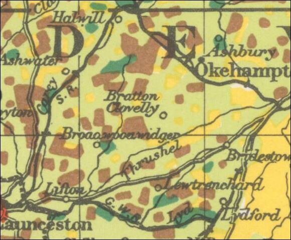 |
||
Roll of Honour Gravesites |
||||
View Roll of Honour Gravesites in a larger map |
This map shows the gravesites of the Bratton Clovelly soldiers who lost their lives in World War I and II. Whether touring in England, on the Continent or in the Middle East, you may want to consider a visit to these sites. |